Free delivery on orders over £35 Branding & personalisation £ Price match guarantee Departmental ordering

Scan a Barcode

Point your camera at a product barcode

Looking for barcode…
FrankFBO Assistant — here to help
Hi! I'm Frank, your FBO assistant. I can help you find products, add items to your basket, and answer questions about delivery and ordering. What are you looking for?
Exercise Books Delivery Info Glue Sticks Branding

Free Delivery For Orders Over £35 (ex VAT) Uk Mainland Only - Departmental Ordering - Branding Specialists - Competitive Pricing - Call Us Today 0800 195 6789


0 £0.00
products in your basketto quote Checkout
Ooops no items were found.
Try something else.
Ok
Loading…

wildgoose Simple Map of the UK

Category Atlas
wildgoose Simple Map of the UK

wildgoose Simple Map of the UK

Product Code: HE1206847
Category Atlas

Description

Atlas! You've found the perfect resource to put Geography learning on the map.

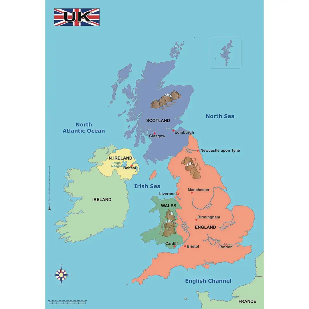
This clear, colourful map of the United Kingdom details the principal towns, cities, seas, rivers and mountains so it is perfect for any classroom or learning environment.

Ideal for delivering key Geography objectives across KS1 and 2, this map can be used to support study about the four countries of the UK and the surrounding seas, as well as contrasting localities.

What's in the Box?

  • 1 x Map of the United Kingdom (Size: 570 x 670 mm)
  • Interactive and colour-coded. This map is perfect for wall displays, as well as for use on a table top with groups of children.
  • Can be used to promote the use of geographical terms and concepts e.g. using compass points and directions.
  • Key mountainous regions are also marked prompting use of key geographical language to be used as part of human and physical geography.
  • Perfect for supporting KS1 Geography objectives i.e. locating and identifying the four countries and capital cities of the United Kingdom and its surrounding seas.
  • Supports learning about the key physical and human characteristics of the UK.

Specifications

Brand

Own Brand

Categories

Learning Materials

Category

Atlas
Starting from
£22.24 Pack of 1
/
- +
Compare

wildgoose Simple Map of the UK

Category Atlas
wildgoose Simple Map of the UK

wildgoose Simple Map of the UK

Product Code: HE1206847
Category Atlas

Description

Atlas! You've found the perfect resource to put Geography learning on the map.

This clear, colourful map of the United Kingdom details the principal towns, cities, seas, rivers and mountains so it is perfect for any classroom or learning environment.

Ideal for delivering key Geography objectives across KS1 and 2, this map can be used to support study about the four countries of the UK and the surrounding seas, as well as contrasting localities.

What's in the Box?

  • 1 x Map of the United Kingdom (Size: 570 x 670 mm)
  • Interactive and colour-coded. This map is perfect for wall displays, as well as for use on a table top with groups of children.
  • Can be used to promote the use of geographical terms and concepts e.g. using compass points and directions.
  • Key mountainous regions are also marked prompting use of key geographical language to be used as part of human and physical geography.
  • Perfect for supporting KS1 Geography objectives i.e. locating and identifying the four countries and capital cities of the United Kingdom and its surrounding seas.
  • Supports learning about the key physical and human characteristics of the UK.

Specifications

Brand

Own Brand

Categories

Learning Materials

Category

Atlas

Starting from
£22.24 Pack of 1
/
- +
Compare
SEARCH ×